Beryl hits Texas this morning, moving through our area Tuesday and Wednesday
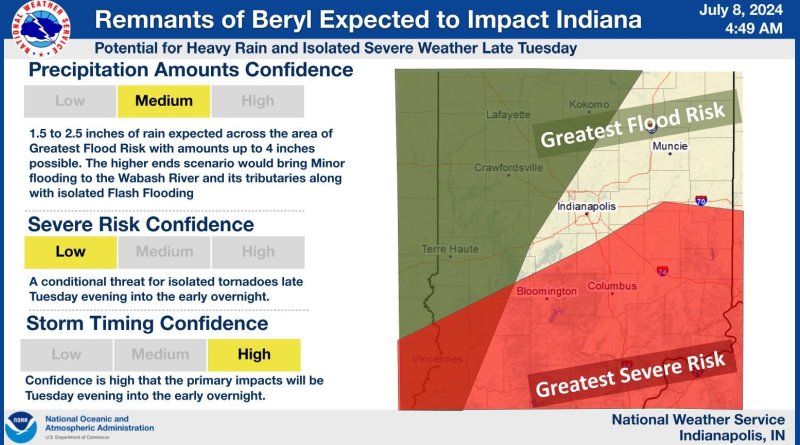
We could see some severe weather Tuesday as remnants of Hurricane Beryl are expected to move through our area.
The National Weather Service in Indianapolis says that Beryl is making landfall on the Texas coast today. Beryl hit land near Matagorda, Texas, about 90 miles southwest of Houston. The Category 1 storm is bringing heavy rains and winds to the Texas coast. The National Hurricane Center puts the storm’s maximum sustained winds at 80 miles per hour.
Beryl is expected to become a tropical depression and move northeast into our area Tuesday. We could see rain and storms Tuesday evening into Wednesday, with our area in the path of the greatest threat of severe weather. The greatest danger is heavy rains with 2-3 inches of rainfall likely. Hurricane remnants can sometimes spawn weak, short-lived tornadoes, forecasters say.
However, the greatest threat will be in southwestern Indiana, where the Wabash Valley could see four inches of rain and flooding.