Officials confirm five tornadoes in Tuesday storms
The National Weather Service says that five tornadoes touched down in Indiana Tuesday including two in area counties.
An EF0 tornado touched down in Shelby County near St. Paul at 7:31 p.m. Tuesday night, traveling more than three quarters of a mile on the ground in about two minutes on the ground with wind speeds of up to 85 mph. It uprooted trees and damaged shingles and gutters. A very old barn also showed some roof damage.
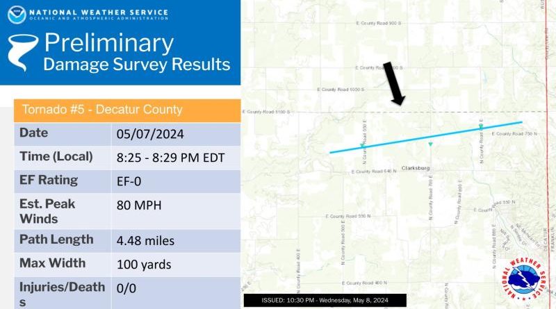
Another EF0 tornado touched down in Decatur County near Greensburg at 8:25 p.m. Tuesday night. It had wind speeds of up to 81 mph and damaged tree branches and utility poles in the four minutes and 4.4 miles it was on the ground.
The most powerful of the Tuesday tornadoes was an EF1 that touched down in Rush County at about 7:45 p.m. and and lifted off about a minute later. It had wind speeds of about 110 mph and hit a metal barn, throwing debris. However grain silos just west of that building and a nearby home were undamaged.
Forecasters say that another round of storms should be pushing through south central Indiana again this afternoon but most of them should be less than severe. But there is still an isolated risk of large hail and damaging wind gusts of up to 60 mph.