Severe weather possible today, Sunday in south, central Indiana
Local emergency officials are warning that we could see some bad weather this afternoon and then again on Sunday.
According to the Bartholomew County Emergency Management office, most of Bartholomew County is under a marginal risk of bad weather this afternoon, with then north western portion of the county under a slight risk.
The bad weather could come through between 4 and 5 today and if it hits, we could see large hail, damaging winds of up to 60 mph, and localized rainfall with up to an inch of rain possible.
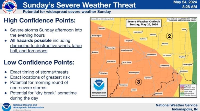
Sunday brings a greater chance of severe weather with the National Weather Service forecasting an enhanced risk with chances for damaging to destructive Winds, possible tornadoes and localized flooding in addition to hail and heavy rain.
The exact timing for Sunday’s weather isn’t known yet, but it is expected to come in waves between 4 and 10 p.m. Sunday with a several hour break before the next wave hits.
Emergency officials encourage you to have multiple ways to receive weather warnings, to have a safety plan in place and be ready to act when severe weather arrives.