Winter storm warning in effect; ice storm warning to the south
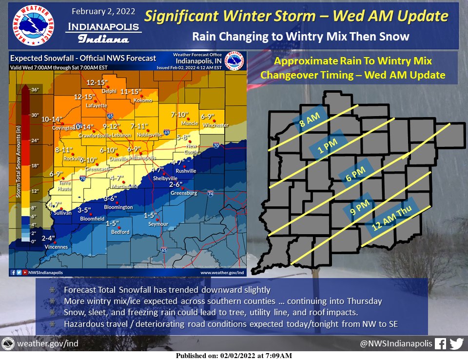
A winter storm warning is now in effect from 7 p.m. tonight through 1 a.m. Friday morning for our area.
The National Weather Service in Indianapolis says affected area counties includes Bartholomew, Brown, Decatur, Jackson, Jennings, and Johnson. Heavy mixed precipitation is expected. Total sleet and snow accumulations in excess of 3 inches and ice accumulations of up to one tenth of an inch are likely in our area. You can expect wind gusts of 30-40 mph starting Thursday morning.
Depending on the area, rain should be switching over to freezing rain and sleet this morning and turning to snow this evening. The agency says that travel could be very difficult, with patchy, blowing snow significantly reducing visibility. You could see bad conditions during your morning or evening commute today and Thursday.
The rain is also expected to cause some flooding along rivers and streams later this week and into the weekend.
An ice storm warning is in effect for far southern Indiana. You can expect power outages and tree damage due to the ice. The weather service says travel could become impossible in those locations.