Update: All of southern, central Indiana under severe storm threat
Storms with damaging winds, hail, heavy rain, and isolated tornadoes will be moving through central and southern Indiana tonight
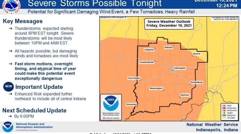
In an update this afternoon, The National Weather Service now has all of southern and central Indiana under an “enhanced” risk. That is everything south of a line roughly from Lafayette to Kokomo and Muncie.
An enhanced risk means that the forecasters are confident that widespread storms will develop, and that these storms are capable of causing significant damage. The biggest threat is wind and tornadoes, but you could heavy rain and localized flooding. Up to an inch and a half of rain is expected with locally higher amounts possible.
The system is projected to move through late this afternoon and stick around through Saturday morning. Forecasters say a first wave of thunderstorms is expected starting around 8 tonight. Severe thunderstorms will be most likely betwen 10 and 4 in the morning.
The weather service warns that the fast moving storms, with the overnight timing and the unusual time of year could make this an exceptionally dangerous weather event.